


home > departments > parks & recreation > bike trails
CUB CREEK PARK MOUNTAIN BIKING TRAILS
View our Park Maps here
The trail status will be posted on the Cub Creek Park's Facebook.
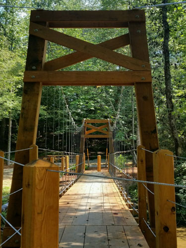
 Experience Our Cantilever Swinging Bridge - Watch Video!
Our cantilever bridge is located between Call Farm & Jail Break loops.
 The Town of Wilkesboro has opened four trails at Cub Creek Park through a partnership with Brushy Mountain Cyclist Club (BMCC) in 2017. The BMCC mountain bikers are responsible for the trails at W. Kerr Scott Dam & Reservoir and Cub Creek Trails are some of the best mountain biking in the southeast, according to their website and riders alike.
Citizens can walk or mountain bike these trails and they are open sunrise to sunset. Please no ebikes.
-
CALL FARM - 3.6 miles - Suble terrain with lots of bermed turns. A great beginner mountain bike riders, hikers & runners. Video1 Video2
-
JAILBREAK - 0.7 miles - Mostly flat trails with a few tricky turns for riders. Video
-
PERKINS PLACE - 2.6 miles - Lots of twists and turns with a little more climbing. Video1 Video2
-
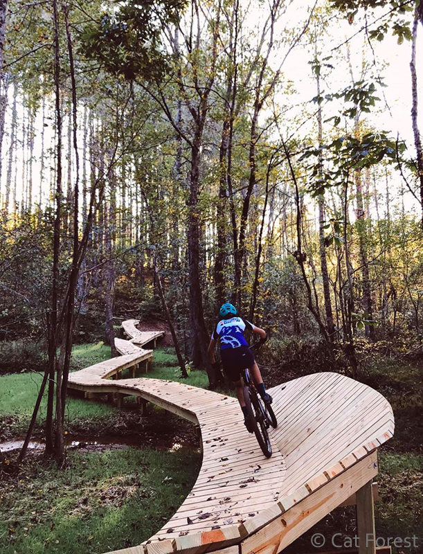
TORNADO ALLEY - 1.4 miles - it will be a casual creekside trail with several boardwalks and bridges mixed with some steeper terrain. Video
Occasionally the trail closed signs have to be posted during wet weather and we ask that you not ride on the trails during closures to keep damage to a minimum. We cannot keep the integrity of the trails without your help. The trail status will be posted on the Cub Creek Park's Facebook.
We would like to give our thanks to the High Country Council of Government for GPS plotting of the trails and trail signs (right) that were done as part of an Eagle Scout's Project.
| Trail Topography | Call Farm Loop | Jail Break | Perkins Place | Tornado Alley |
|---|---|---|---|---|
| Length (ft) | 17,755.04 | 3,632.75 | 13,471.87 | 7,447.68 |
| Length Miles | 3.363 | 0.688 | 2.551 | 1.411 |
| Elevation Minumum (ft) | 964.097 | 972.044 | 962.375 | 974.284 |
| Elevation Maximum (ft) | 1,044.01 | 1,001.21 | 1,047.17 | 1,043.31 |
| Elevation Mean (ft) | 1,000.87 | 986.745 | 1,008.55 | 1,004.65 |
| Minimum Slope | 0 | 0.036 | 0 | 0 |
| Maximum Slope | 52.458 | 36.06 | 52.777 | 44.321 |
| Average Slope | 6.481 | 7.123 | 11.632 | 6.59 |
Currently, the trails can be viewed electronically on the
Wilkesboro Park Maps.
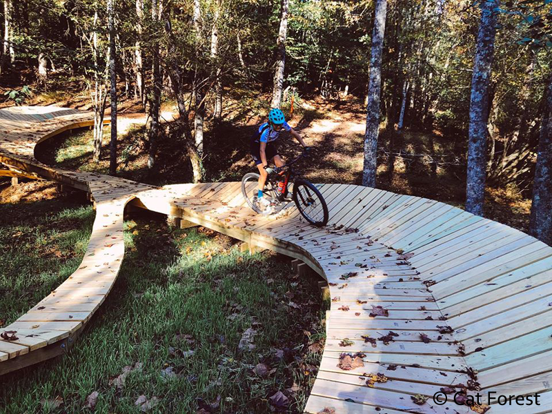
Tornado Alley